LZControl Mobile
Your Complete Landing Zone Solution
Built for helicopter air ambulance crews, EMS, and aviation professionals
Your Complete Landing Zone Solution
Built for helicopter air ambulance crews, EMS, and aviation professionals
If you previously downloaded the Android app, please note that we've released a completely new app with enhanced features and performance. The old app will no longer receive updates. You'll need to download the new version from the link below.
Download New Android AppThe new LZControl mobile app brings professional-grade landing zone management to your fingertips with features designed specifically for emergency aviation operations.
Download complete state packs and access all LZ data without cellular coverage. Perfect for rural operations and remote areas.
Lightning-fast updates that only sync what's changed. Stay current without draining battery or burning data.
Add new LZs, update existing ones, and manage all details directly from the field. Your changes sync automatically when back online.
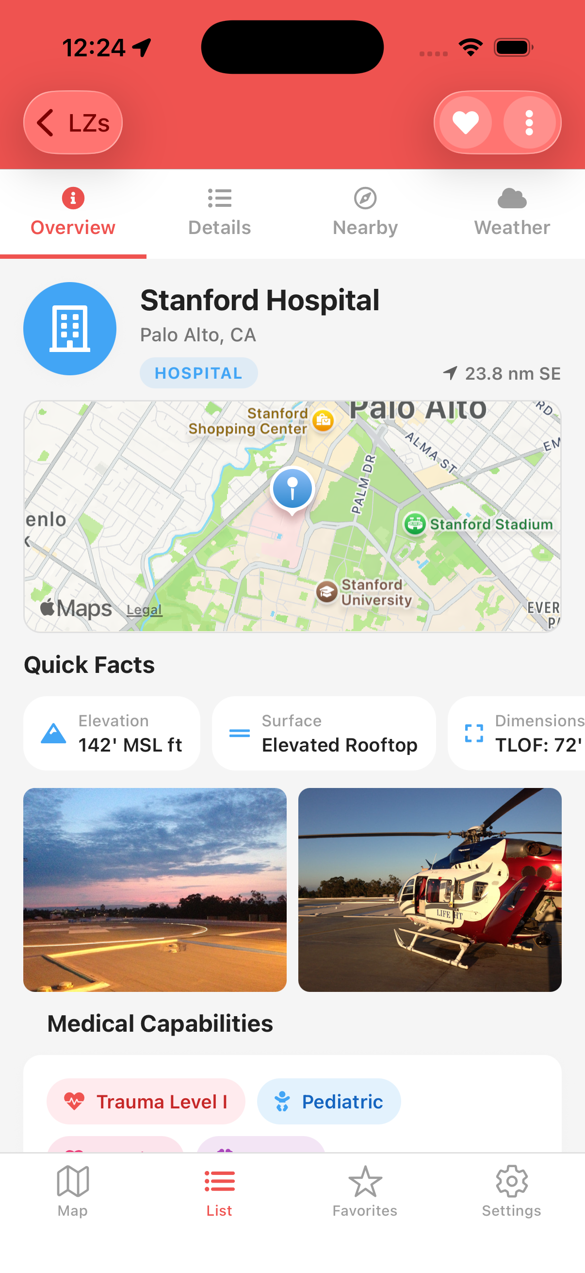
Upload multiple high-resolution images with captions. Automatic thumbnail generation for fast loading.
Real-time METAR/TAF data, VFR/IFR conditions, and weather at your location or destination LZ.
Quick access to your frequently used landing zones. One-tap navigation to your saved locations.
Modern interface designed for quick decisions in high-pressure situations
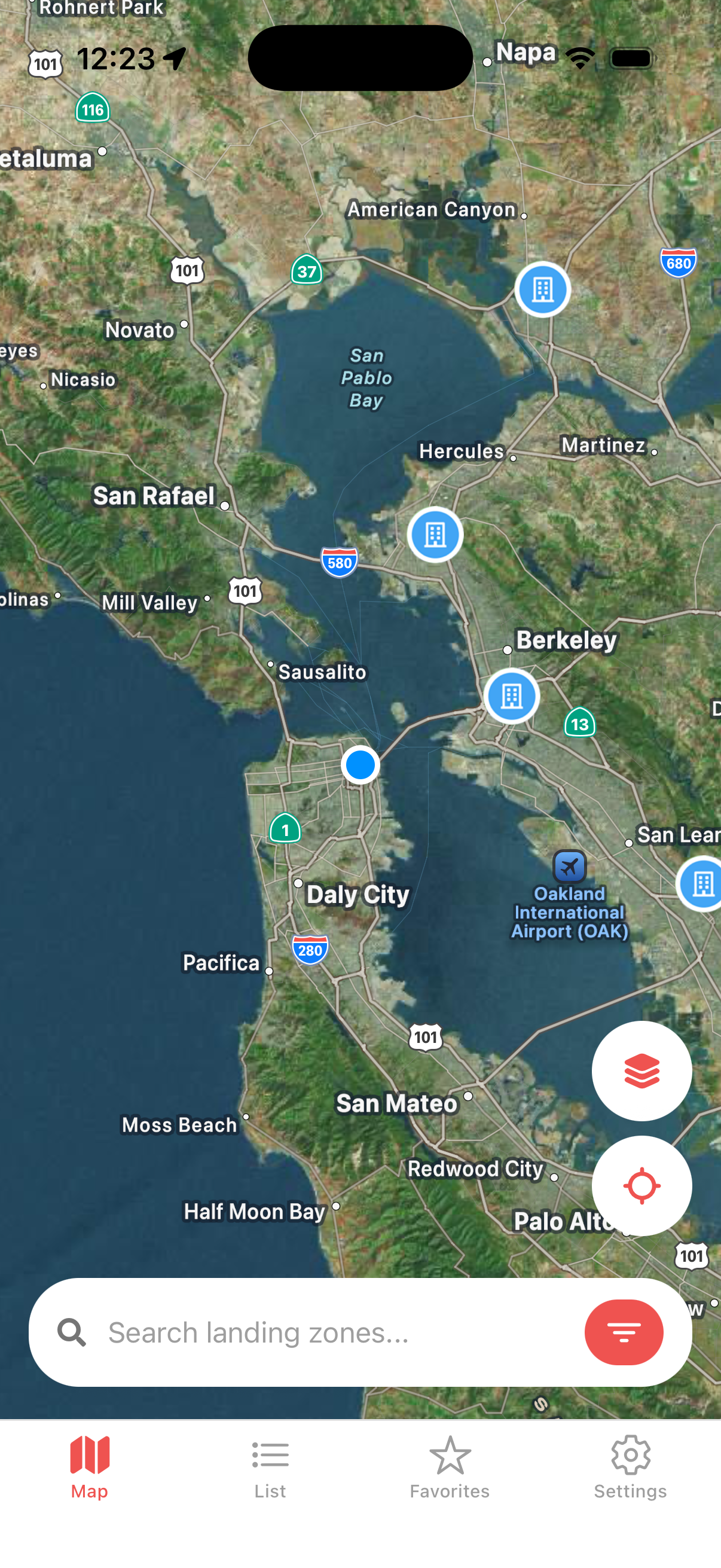
Quick access to verified landing zones with weather, photos, and hazard information. Update scene LZs from the field to help future crews.
Find and set up suitable landing zones for incoming aircraft. Maintain pre-designated LZs with current hazard and contact information.
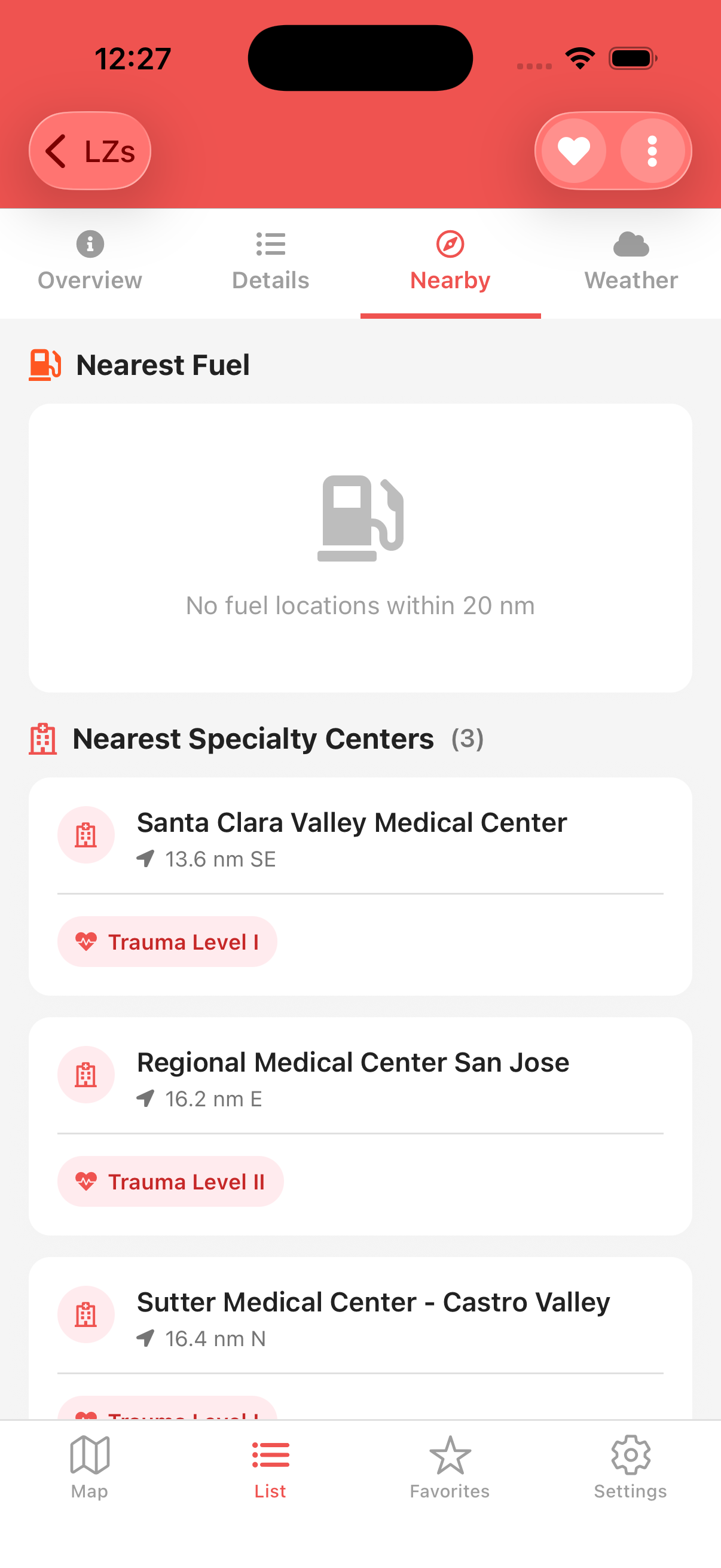
Comprehensive airport database with weather, fuel availability, and distance calculations. Plan your route with confidence.
A complete rebuild from the ground up with modern technology and user-requested features
Download entire state packs for complete offline access. All core features work without an internet connection, with automatic sync when you're back online.
No longer read-only! Create new landing zones, update existing ones, and upload photos directly from your mobile device. Changes are queued offline and synced automatically.
Built with React Native for true native performance. Faster load times, smoother animations, and better battery life than the previous version.
Powered by our new v2 API with version-based delta sync, conflict resolution, and granular permissions. Only downloads what's changed since your last sync.
Upload up to 5 high-resolution photos per landing zone with captions. Automatic thumbnail generation ensures fast loading on any connection.
Professional dark theme designed to preserve night vision. High contrast interface readable in all lighting conditions.
Download LZControl now and experience the next generation of landing zone management.
Free for all users • Available on iOS and Android